Friday, May 31, 2013

Villaviciosa

May 31. Villaviciosa

We left our albergue in La Isla at 7. Today is a short day because we are only going 22k. It is the only way we could divide up a long stage. We are on the central coastal area of Asturias known for its horses. Don't expect to only see a cow when you hear a cow bell. Today we walked through villages and hamlets. Once again many Eucalyptus Forests. A lot of the native trees have been supplanted by the Eucalyptus. They were introduced because they grow fast and were originally used to shore up mines and to make paper. The conservationists are concerned. The views of the fields and the horses and cows are splendid. According to one of the locals we spoke to yesterday there has only been 2 days of sun since Jamuary. This makes for beautiful green fields. Unfortunately, for those walking the paths a muddy, slippery mess awaits; and, you need tenacity to win the day. After slogging through the mud we arrive in Villaviciosa. A lovely city with lots going on. We checked into our rooms, showered, shopped and went out for a delicious late lunch. Tomorrow, Gijon a challenging 27K away with a 400 meter climb followed by a 200 meter one.

Morning sun, the first time we have been dry all day.

Days don't seem to be getting easier. Ups and downs continuously.

Once off the road mud plagues us.

You must have planning stops.

A man in deap thought.

Can you imagine the time.....

People aren't important here, the sunshine is.

Always the views....

Another 1.5 hours we will be there in the distance.

The Camino fighting back. Kilometers of this stuff. Joan wearing her wet washed clothes from yesterday.

Yesterday's wash getting dried at Cafe del Sol, Villaviciosa


Stu uses MotionX-GPS on the iPhone and is sharing with you the following track:

Name:Villavicisoa
Date:May 31, 2013 6:48 am
Map:
(valid until Nov 27, 2013)
View on Map
Distance:21.9 kilometers
Elapsed Time:5:32:22
Avg Speed:4.0 km/h
Max Speed:11.2 km/h
Avg Pace:15' 09" per km
Min Altitude:0 m
Max Altitude:186 m
Start Time:2013-05-31T04:48:43Z
Start Location:
Latitude:43º 29' 04" N
Longitude:5º 13' 40" W
End Location:
Latitude:43º 28' 52" N
Longitude:5º 26' 06" W


Thursday, May 30, 2013

La Isla

May 30 La Isla

We left our rooms at Pension Jorje in Nueva. We were given a pilgrim rate which was a mixed blessing - towels but no sheets, hot water but no heat. We paid 20€ for a single and 30€ for a double. We had a lovely dinner at the bar across the street for 8€ each. We also had a great cocktail hour before dinner in our room. We had beer, olives, salami, toast and flan, an interesting combination. We left early prepared for rain; however, we experienced just a few sprinkles. We took the highway route 263 direct to Rioadesella. This town of some 3000 was one of Astorias main ports in the Middle Ages. Today it is a tourist destination with many villas by the sea.

At this point the highway looses its walking shoulder; so, we followed the yellow arrows. The Camino runs through meadows and pastures ending at the edges of cliffs that fall off to the ocean many stories below. Mixed in were apple orchards and Eucalyptus forrests . We had the coast on one side and Mountain Sueve on the other. There were portions of the trail where the mud almost topped our boots and became extremely narrow bordered by brambles. We were tired when we finally pulled into La Isla and to our albergue. Though only 28k we battled the mud which slowed us down and wore us out. We ate early and are now in bed reading and recuperating for a shorter day tomorrow.


Planning the next coffee stop

The first and last. Middle taking picture.

Patience, older folk catching up.

Crossing a bridge.

Closing in on us

Do you see the path ?

Certain death to the right. Electric fences.

What is interesting in this picture?

George opens fences for us.

Alberque at La Isla

Kitchen, we always go out to eat.

Stu uses MotionX-GPS on the iPhone and is sharing with you the following track:

Name:La Isla
Date:May 30, 2013 6:30 am
Map:
(valid until Nov 27, 2013)
View on Map
Distance:28.9 kilometers
Elapsed Time:7:06:08
Avg Speed:4.1 km/h
Max Speed:10.6 km/h
Avg Pace:14' 44" per km
Min Altitude:0 m
Max Altitude:103 m
Start Time:2013-05-30T04:30:35Z
Start Location:
Latitude:43º 26' 18" N
Longitude:4º 56' 10" W
End Location:
Latitude:43º 29' 04" N
Longitude:5º 13' 40" W


Wednesday, May 29, 2013

Nueva

May 29 Nueva

At 0700, we left our lovely room over the bar, built 1859, at Pendueles on the way to Llanes. We decided to be real pilgrims and walk the E9 through the coastal farm lands. When we left it was raining and it continued through out the day. The scenery along the coast was spectacular with blow holes in the rocks below. Llanes is a big city with blocks of shops and restaurants the houses according to our guide reflect both Cuban and Mexican immigration. It took us almost 3 and a half hours to get into llanes. We decided to take the mountain route along side a seaming endless golf course which wound around the city. The wind on the cliffs was strong and the rain persistent. After a brief rest and coffee in Llanes, we continued our walk along the coastal route. The next 20 k was arduous with rain and wind and not very good way markers. In spite of that the beauty of the coast out weighs the difficulties. Fortunately, I contacted Pension Jorje yesterday to reserve rooms in Nueva. After33 k and 7 hours of walking we could not have gone much further. We are now ensconced in our pension. The cost for pilgrims is 20€ for a single and 30€ for a double. Pilgrim meal at the bar, close by, is 8€. The grocery store opens between 1630 and 1700.


A deserving rainbow

Camping site when the dun shines

Still buddies?

The coastal E9

Blow hole

Just of the trail

View of Llanes from golf course.

G & J ahead again

Nuestra Sheñora de Los Dolores, Barru

Eagerly awaiting a meal

Cocktail hour, who knows how long

No heat, the price of being a pilgrim.

Stu uses MotionX-GPS on the iPhone and is sharing with you the following track:

Name:Nueva
Date:May 29, 2013 7:06 am
Map:
(valid until Nov 27, 2013)
View on Map
Distance:33.2 kilometers
Elapsed Time:7:43:36
Avg Speed:4.3 km/h
Max Speed:6.8 km/h
Avg Pace:13' 58" per km
Min Altitude:0 m
Max Altitude:158 m
Start Time:2013-05-29T05:06:11Z
Start Location:
Latitude:43º 23' 48" N
Longitude:4º 38' 12" W
End Location:
Latitude:43º 26' 17" N
Longitude:4º 56' 11" W


Tuesday, May 28, 2013

Pendueles

Pendueles

Today was our last walk in Cantabria. We are heading inland along the western coastline. We walked today through rough landscapes with small hillside meadows and limestone mountains. We walked across the flat topped costal hills which are typical in this part of Cantabria. Our first coffee break was in Unquera. This town has developed for tourism offering adventures such as canoeing and hiking using the rivers and the mountains around town. We passes through Bustio at the foot of the Sierra Plana mountain range.We then walked back up the mountains to Colombres. Colombres has some beautiful architecture housing both the town hall and an Indian museum. We continued another 6 k to our resting spot Pendueles. We were going to stay in a lovely new albergue here but since it did not open for 2 hours I found some great rooms over a bar for $25 euros a night. It has wifi and they so your laundry You can hardly beat that. They will fix us an early dinner at 6 of fish and vegetables and salad with ice cream for desert. The cost is 7 euros each. George being much more practical and patient went to the albergue where the meal and the bed is donation only.


Just another view.

Second coffee stop. Getting the guide books out to check.

Leaving Barquera

From google photos

Joan waving good bye from her room in Pendueles

Watching the Italians leaving from Pendueles

Room at Pendueles


Stu uses MotionX-GPS on the iPhone and is sharing with you the following track:

Name:Pendueles
Date:May 28, 2013 6:21 am
Map:
(valid until Nov 24, 2013)
View on Map
Distance:22.6 kilometers
Elapsed Time:5:38:13
Avg Speed:4.0 km/h
Max Speed:7.2 km/h
Avg Pace:14' 56" per km
Min Altitude:0 m
Max Altitude:133 m
Start Time:2013-05-28T04:21:41Z
Start Location:
Latitude:43º 23' 04" N
Longitude:4º 24' 10" W
End Location:
Latitude:43º 23' 48" N
Longitude:4º 38' 12" W


Monday, May 27, 2013

San Vicente de la Barquera

San Vicente de la Barquera

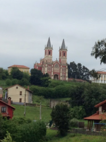
We left our lovely rooms in Santillana del mar and started our journey. We wound our way through costal valleys that merge with the sea. Our first stop was Cobreces. It is a town that goes back to the 10th century and where we reconnect with the coast. There is a monastic complex built in the 20th century but in a neo gothic style. The twin towers guide the walkers from a distance. Our second stop and first coffee was Comillas. There are wonderful emblematic buildings as well as some neo gothic ones. The chapel designed by Gaudi. " El Capricho " is a symbol of the town. Our plan was to stay here but it was too early so we walked on to San Vicente. Signs of its medieval past are still present. On entering the city you see the kings castle. On the other end up by the albergue is the church of Santa Maria de Los Angeles. We found our albergue high on the hill. It is 13 euros for a bunk, dinner, and breakfast..


One of many coffee breaks managed by George.

Just another beautiful view along the way


Stu uses MotionX-GPS on the iPhone and is sharing with you the following track:

Name:San Vicente
Date:May 27, 2013 6:25 am
Map:
(valid until Nov 23, 2013)
View on Map
Distance:29.5 kilometers
Elapsed Time:6:43:06
Avg Speed:4.4 km/h
Max Speed:7.6 km/h
Avg Pace:13' 40" per km
Min Altitude:0 m
Max Altitude:145 m
Start Time:2013-05-27T04:25:51Z
Start Location:
Latitude:43º 23' 30" N
Longitude:4º 06' 19" W
End Location:
Latitude:43º 23' 03" N
Longitude:4º 24' 11" W